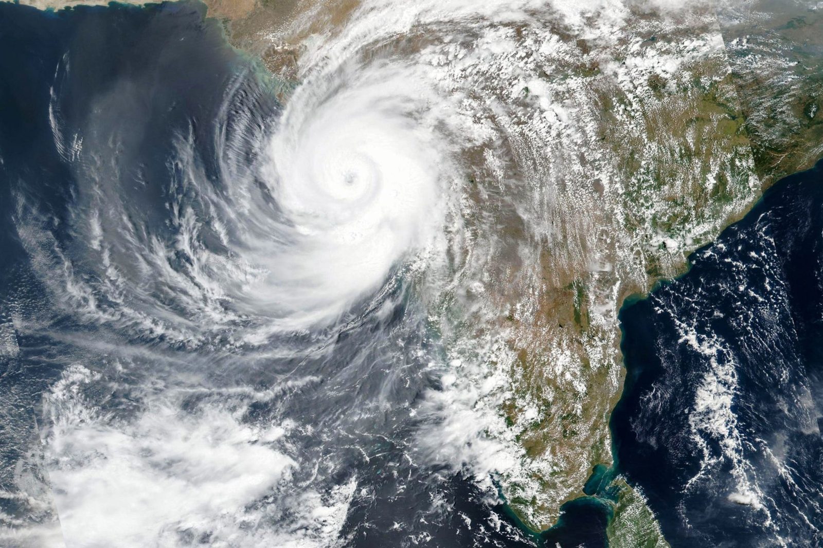
Very severe cyclonic storm Arnab began crossing India's Andhra Pradesh coast in the early hours of Wednesday, October 28, bringing destructive winds, torrential rain and coastal flooding to communities that had spent days preparing for its arrival. The India Meteorological Department (IMD) said the landfall process started at about 1:20 a.m. local time and was expected to take around four hours to complete.
The storm crossed the coast between Bapatla and Visakhapatnam, just south of Yanam, as a very severe cyclonic storm, with maximum sustained winds of 125–135 km/h and gusts reaching 150 km/h. IMD Director General Mrutunjay Mohapatra said those wind speeds would persist for roughly the next four hours after landfall began, and that the tip of the system had already moved over land.
A storm days in the making
Arnab is the first cyclonic storm of the 2026 North Indian Ocean cyclone season, and its approach had been tracked for days as it intensified over the west-central Bay of Bengal. By Tuesday it had strengthened into a very severe cyclonic storm, prompting red warnings for the Andhra Pradesh coast and adjoining south Odisha, and orange alerts across a string of coastal districts in both states.
Schools were closed, fishing was banned along the coast, and rescue teams were placed on standby well before the storm arrived. The system had been moving west-northwest at around 20–25 km/h before turning towards the coast, and forecasters had warned of a storm surge pushing waves 1–2 metres above the normal tide, with the greatest inundation risk around Kakinada and Yanam.
That forecast proved accurate in the first hours of landfall. Heavy rainfall and strong winds swept coastal Andhra Pradesh, Yanam and parts of southern Odisha through the night, while a storm surge pushed seawater into low-lying areas.
Flooding in Yanam, trees down on the highway
Yanam, the small Puducherry enclave on the Andhra coast, felt the storm's force early. Heavy rain and gusty winds began sweeping the region on Tuesday night, and the sea level surged by three to four feet at Savitri Nagar, flooding the ground floor of a local relief camp. Puducherry Minister Malladi Krishna Rao visited the flooded neighbourhood in the early hours of Wednesday to assess the situation and speak with residents.
Elsewhere, the wind tore through roadside vegetation: several trees were uprooted near the Yanam entrance on National Highway 216, according to disaster management officials, and rough seas battered the coastline around Kakinada, where high waves displaced protective boulders onto a road at Uppada beach. Authorities had barred public access to beaches as a precaution, and fishing communities had been moved to safer ground — at Paradip port in Odisha, 305 fishermen were given shelter inside the harbour.
Andhra Pradesh's disaster management authority had warned residents in vulnerable areas to stay indoors and follow official safety instructions as rainfall and wind intensity increased through the night. The state and its neighbours had spent the preceding days stocking relief camps, keeping medical services running around the clock and preparing power and telecom crews for damage to poles and lines.
What happens next
Once the landfall process completes, Arnab is expected to weaken as it moves inland, but the danger does not end at the coast. The IMD and state authorities have warned of continued heavy to very heavy rainfall at isolated places, including in Chhattisgarh on Wednesday and Thursday, as the system's remnants track inland. Officials in Chhattisgarh have directed electricity departments to prepare for damage to power poles and to clear fallen trees quickly to keep roads open.
The wider picture is one of a region tested by increasingly familiar extremes: coastal states on the Bay of Bengal face a cyclone season that regularly brings powerful storms ashore, and Arnab's landfall — with its surge, flooding and destructive gusts — is a reminder of why early warnings, evacuations and shelter capacity matter as much as the forecast itself.
For now, the focus in Andhra Pradesh and Yanam is on the immediate aftermath: clearing roads, restoring power, checking on residents in flooded areas, and counting the damage once daylight allows a full assessment. No casualty figures had been reported in the first hours after landfall.
Read our earlier coverage of the storm's approach: Bay of Bengal Storm on Course to Become a Very Severe Cyclone Before Striking India's Andhra Coast on October 28. For another recent extreme-weather event, see Rare Tornado Strikes Antalya and Kills Four Construction Workers in Southern Turkey.
Frequently Asked Questions
When did Cyclone Arnab make landfall?
The landfall process began at about 1:20 a.m. local time on Wednesday, October 28, according to the India Meteorological Department, and was expected to take around four hours to complete.
Where did the cyclone cross the coast?
Arnab crossed the Andhra Pradesh coast between Bapatla and Visakhapatnam, just south of Yanam, in southern India.
How strong were the winds at landfall?
Maximum sustained winds were 125–135 km/h, with gusts reaching up to 150 km/h, the IMD said.
Which areas were affected?
Coastal Andhra Pradesh, Yanam and parts of southern Odisha bore the brunt, with heavy rain, strong winds and coastal flooding; inland states including Chhattisgarh were warned of heavy rain as the system weakened.
What is Cyclone Arnab?
Arnab, pronounced "Ornab", is a very severe cyclonic storm over the Bay of Bengal and the first cyclonic storm of the 2026 North Indian Ocean cyclone season, according to the IMD.
Sources: The Indian Express, Moneycontrol, The Times of India.