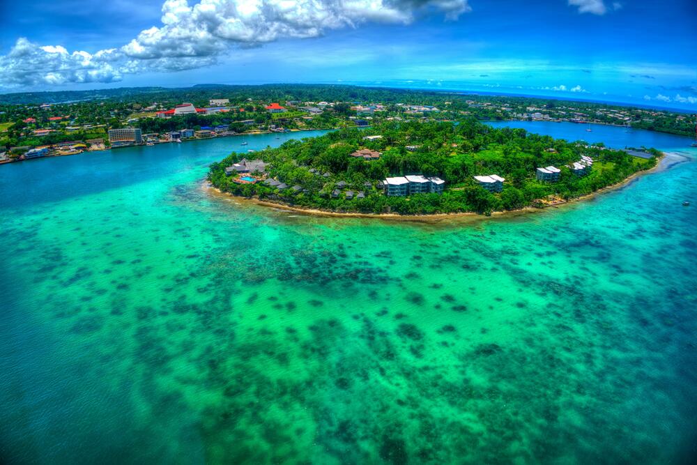
Two powerful earthquakes struck the waters off Vanuatu in the South Pacific on Saturday, triggering a tsunami warning for coastlines within 300 kilometres of the epicentre before authorities cancelled the alert hours later. The United States Geological Survey (USGS) initially reported a magnitude 7.2 tremor, later revising it to 6.9, and recorded a second quake of magnitude 6.3 nearby, according to CNBC-TV18.
Table of Contents
- What happened in the early hours
- The tsunami warning — and why it was lifted
- Life on the ground: precaution, not panic
- Why Vanuatu shakes so often
- What happens next
- Frequently Asked Questions
What happened in the early hours
The first and largest tremor struck at 2:31 a.m. UTC on Saturday, 24 October, with its epicentre roughly 200 kilometres west of Sola, on Vanuatu's northern island of Vanua Lava, at a shallow depth of about 10 kilometres. Shallow earthquakes of this size are the ones seismologists watch most closely, because they displace more of the sea floor and carry a greater tsunami risk than deeper events of the same magnitude.
The sequence of readings caused some early confusion. Some outlets reported a magnitude 6.9 reading roughly 25 seconds after the first, placing it about 197 kilometres west-northwest of Port-Olry, and it remains unclear whether that figure was a second, distinct shock or a revised estimate of the same event, according to Mathrubhumi. What is not in doubt is that the region experienced a burst of strong seismic activity in a short window, including a separate magnitude 6.3 tremor recorded nearby.
The USGS later settled on 6.9 for the main shock. The difference between 7.2 and 6.9 may sound small, but on the logarithmic magnitude scale it represents a meaningful reduction in released energy — one reason early headlines and later assessments of the event can look quite different.
The tsunami warning — and why it was lifted
Within minutes of the main shock, the Pacific Tsunami Warning Centre in Hawaii advised that hazardous tsunami waves were possible for coasts within 300 kilometres of the epicentre. Its initial advisory put the first wave's expected arrival at Espiritu Santo, Vanuatu's largest island, at around 3:01 a.m. UTC, while cautioning that arrival times could vary and that the first wave is not necessarily the largest.
Vanuatu's own authorities echoed the alert, urging coastal residents to move to higher ground. The warning was then cancelled after sea-level readings and further analysis showed no destructive wave had been generated. The cancellation is a normal part of the system: tsunami centres would rather warn early and stand down than wait for confirmation while waves are already travelling. As with other recent Pacific scares — including the tsunami warning issued after the Panama earthquake — the alert did its job as a precaution even though the worst case did not materialise.
Life on the ground: precaution, not panic
There were no immediate reports of casualties or significant structural damage, a fortunate outcome given the size of the shocks. Some residents of coastal communities such as Hog Harbour moved to higher ground as a precaution before the threat passed, and officials continued to advise people to follow notices from Vanuatu's authorities and recognised warning agencies.
Former prime minister Charlot Salwai used social media to warn the public about ongoing aftershocks and to urge continued caution even after the warning was lifted — a reminder that a cancelled tsunami alert does not mean the seismic sequence is over. Aftershocks are expected after events of this size, and authorities typically keep monitoring in place for days.
The absence of damage reports so far also reflects geography: the epicentres lay well offshore, in open water, rather than beneath a town. Distance from shore is often the decisive factor in whether a large earthquake becomes a disaster or a scare.
Why Vanuatu shakes so often
Vanuatu sits squarely on the Pacific Ring of Fire, the arc of intense seismic and volcanic activity that runs through Southeast Asia and across the Pacific basin. The archipelago is caught between converging tectonic plates, and powerful earthquakes are a regular feature of life there rather than a rarity.
That history cuts both ways. It means the country has hard-won experience with evacuation drills, warning systems and community response — experience that was on display on Saturday as residents moved uphill without waiting for confirmation of a wave. But it also means the risk never truly recedes: the same plate boundaries that produced Saturday's shocks will produce more, and the difference between a warning and a catastrophe can come down to minutes and metres.
The region has seen the grimmer side of that equation recently. Just days earlier, a magnitude 7.0 earthquake in Tibet's Nagqu region killed at least 16 people, as covered in Tibet's deadly Nagqu earthquake — a reminder that similar magnitudes can have very different consequences depending on depth, location and building standards.
What happens next
Seismologists will continue to refine the record of Saturday's sequence — confirming magnitudes, depths and whether the near-simultaneous readings were one event or two — while Vanuatu's disaster officials assess any damage in remote coastal areas that may not yet have reported in. Residents have been told to stay alert for aftershocks and to follow official updates rather than rumours on social media.
For the wider Pacific, the episode is a useful stress test of a warning chain that has to work across vast distances and many island nations. This time, the chain held: detection was fast, the warning went out within minutes, coastal communities responded, and the all-clear followed once the data supported it. That is the system working as designed — even when, mercifully, the wave never comes.
Frequently Asked Questions
How big were the Vanuatu earthquakes?
The USGS initially reported a magnitude 7.2 earthquake, later revising it to 6.9, and recorded a second nearby quake of magnitude 6.3. Some outlets reported a 6.9 reading seconds after the first shock; whether that was a separate event or a revised estimate is still being clarified.
Was there a tsunami?
A tsunami warning was issued for coasts within 300 kilometres of the epicentre, but it was later cancelled after no destructive wave was observed. No tsunami damage has been reported.
Were there any casualties or damage?
There were no immediate reports of casualties or significant structural damage. Some coastal residents moved to higher ground as a precaution, and authorities continue to monitor for aftershocks.
Why does Vanuatu get so many earthquakes?
Vanuatu lies on the Pacific Ring of Fire, where tectonic plates converge beneath the archipelago. Large earthquakes are a regular occurrence there, which is why the country maintains tsunami warning systems and evacuation procedures.